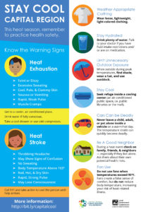
Increasing temperatures, urbanization, greenhouse gas (GHG) emissions, and an aging demographic will all exacerbate the impacts of urban heat. As for us, heat can lead to heat rashes, heat cramps, heat exhaustion, and in the most severe cases, heat stroke. Furthermore, heat can worsen existing medical conditions, including:
-
- Asthma — Heat and light react to increase ozone (smog) pollution levels, leading to poor air quality. The increase in ozone pollution makes it more difficult to breathe and can cause asthma flare-ups. Want to learn more? The American Lung Association’s 2018 State of the Air ranked the Sacramento-Roseville region as the 5th most ozone-polluted urban area in the entire United States (compared to 8th in 2017).
- Cardiac Disease — Some medications, combined with heat, can hinder the body’s ability to regulate temperature, increasing the risk of death. This is because the body’s natural heat regulation strategies, radiation and evaporation, stress the heart. Having a weakened heart during a heat wave event increases the chances for heat stroke.
- Diabetes — Heat can lead to fluctuations in blood sugar levels. For example, increased temperatures can increase blood sugar if not properly hydrated (glucose levels become more concentrated, which triggers further urination, and thus dehydration). However, higher body temperatures can also lower blood sugar levels, because higher temperatures dilate blood vessels, which in turn enhance insulin absorption.
In short, if you have a pre-existing medical condition, it is important to follow your doctor’s recommendations, especially with higher health risks due to increasing temperatures.
But how does heat affect the human body? The short version: in response to initial heat exposure, the body’s heart rate increases, leading to vasodilation (widening of the blood vessels), increases circulation to the skin, and triggers sweat glands (a cooling mechanism via heat transfer). However, prolonged heat exposure compromises blood flow to critical internal organs, and continued sweating (dehydration) depletes the plasma volume and electrolytes. If dehydration continues, the body’s thermoregulatory process is impaired, threatening both the cardiac and nervous systems. When heat exposure becomes severe enough, prolonged internal body temperatures can start to affect normal body functions and can lead to organ failure. Without immediate medical attention, death is likely to ensue. Want to learn more? Read about the 27 potential ways heat can lead to death.
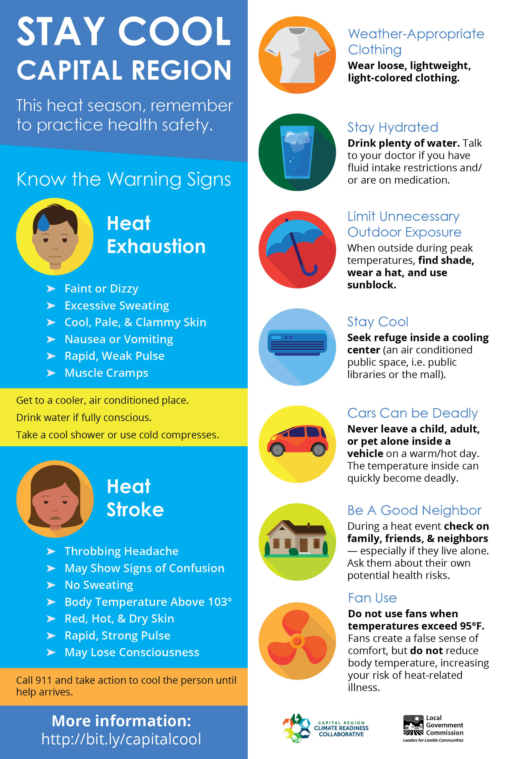
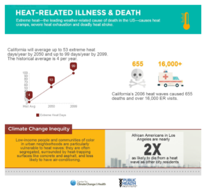 (click image to enlarge)


